![]()
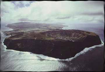
Rano Kau, on the southwest side of the island, as seen from the air
Courtesy of Juan Pablo Lira
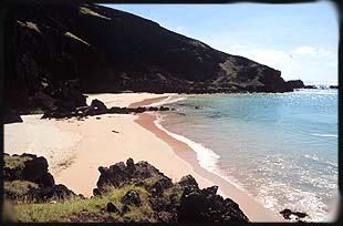
 Anakena
is a beautiful white sand beach stands out from the rest of the coastline,
which is either sharp black lava rock or vertical cliff faces hundreds
of feet tall.
Anakena
is a beautiful white sand beach stands out from the rest of the coastline,
which is either sharp black lava rock or vertical cliff faces hundreds
of feet tall.
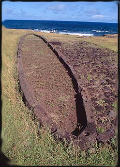
It is at Anakena that the legends say Hotu Matua landed and began the colonization of the island. Excavations of this area have discovered that it was an important site and it boasts one of the best collections of erected Moai on the island, Ahu Naunau. The voyagers started constructing villages and houses made in an unusual elliptical shape. It has been speculated that this style of construction started when the new arrivals turned their boats upside down for quick housing. There were literally hundreds of remains of these foundations on the island in the 1800's, but most were destroyed by the missionaries to make fences.
Indeed, the missionaries did more damage to the island's history than even the Peruvian slave traders, which carted off most of the island's population. Those who escaped by hiding in the island's many caves were "saved" by these missionaries, who proceeded to destroy all the islander's wooden sculptures, religious artifacts and most importantly, the Rongo- Rongo tablets, which contained a record of the lost language of the Rapa Nui. So few of these tablets remain that no one has been able to decipher them satisfactorly.
The first islanders found a lush island, filled with giant Palms which they used to build boats and housing. The plants they brought with them did well in the rich volcanic soil and by AD 1550 population on the island hit a high of between 7000 and 9000.
Distinct clans formed as the population increased and various population centers grew up in different areas of the island. One thing tied them all together, however, the statue construction and the cult that formed around it.
©2000 Myths & Mysteries of the World
All rights reserved. Unauthorized copying and
manipulation is prohibited.